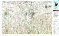
1986 Map of Canton
USGS Topo · Published 1989About this map
The industrial heart of northeast Ohio is recorded here during the mid-1980s, centered on the urban corridor from Akron south through Canton and Massillon. The landscape reflects a dense network of manufacturing and transit, dominated by the Timken Roller Bearing Plant and Republic Steel Plant, and supported by an intricate system of railroads including the Consolidated Rail Corporation and the Wheeling and Lake Erie Railway. This era shows the region’s evolution from heavy industry to a cultural and educational hub, evidenced by landmarks like the Pro Football Hall of Fame and the McKinley National Memorial.
Find a feature on this map
262 named features on this map. Tap any name to fly to it.
Don’t see what you’re looking for? This feature index may not catch every label — zoom into the map to look around manually.
Map Details
Editions of this 1986 Canton Map
2 editions found
Other maps of this area

1901 · Cadiz
USGS Topo · 1:62,500

1901 · Massillon
USGS Topo · 1:62,500

1901 · Canton
USGS Topo · 1:62,500

1901 · Wooster
USGS Topo · 1:62,500

1902 · Scio
USGS Topo · 1:62,500

1903 · Massillon
USGS Topo · 1:62,500

1903 · Wooster
USGS Topo · 1:62,500

1903 · Canton
USGS Topo · 1:62,500

1903 · Cadiz
USGS Topo · 1:62,500

1903 · Akron
USGS Topo · 1:62,500