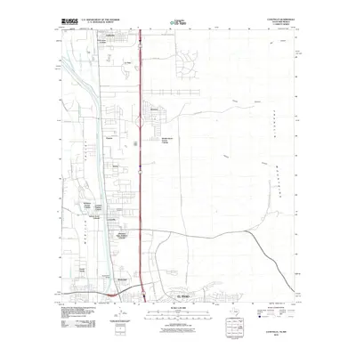
2010 Map of Canutillo
USGS Topo · Published 2010About this map
The Mesilla Valley serves as a corridor for settlement and transit along the Rio Grande as it flows toward El Paso. In this era of residential expansion, the landscape is defined by numerous colonias and additions, including R W Jones Colonia, Mobile Haven Estates Colonia, and the Hermosa Vista Addition Colonia. These communities sit between the river's complex irrigation network, featuring the Anthony Drain and Vinton Lateral, and the rising slopes of the Franklin Mountains to the east. The map records important local landmarks such as the Canutillo Cemetery and the Borderland Bridge, while identifying established hubs like Anthony, Vinton, and La Tuna. This survey documents the transition of former agricultural lands into suburban developments while maintaining the vital water infrastructure necessary for valley life.
Find a feature on this map
53 named features on this map. Tap any name to fly to it.
Don’t see what you’re looking for? This feature index may not catch every label — zoom into the map to look around manually.
Map Details
Editions of this 2010 Canutillo Map
This is the sole edition of this map. No revisions or reprints were ever made.
Other maps of this area

1891 · Las Cruces
USGS Topo · 1:125,000

1893 · Las Cruces
USGS Topo · 1:125,000

1896 · El Paso
USGS Topo · 1:125,000

1908 · El Paso
USGS Topo · 1:125,000

1917 · Canutillo
USGS Topo · 1:62,500

1919 · Canutillo
USGS Topo · 1:62,500

1940 · Newman
USGS Topo · 1:62,500

1941 · El Paso
USGS Topo · 1:31,680

1942 · Fort Bliss
USGS Topo · 1:62,500

1943 · La Mesa
USGS Topo · 1:62,500