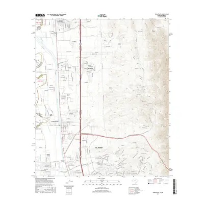
2016 Map of Canutillo
USGS Topo · Published 2016About this map
The Rio Grande serves as the central artery and state boundary in this 2016 survey, where the river's floodplain supports a network of irrigation laterals and drains like the Three Saints Lateral and Vinton Drain. This desert landscape is defined by the sharp transition from the fertile Mesilla Valley floor to the high elevations of the Franklin Mountains, punctuated by deep incisions like Vinton Canyon and Avispa Canyon.
Find a feature on this map
206 named features on this map. Tap any name to fly to it.
Don’t see what you’re looking for? This feature index may not catch every label — zoom into the map to look around manually.
Map Details
Editions of this 2016 Canutillo Map
This is the sole edition of this map. No revisions or reprints were ever made.
Other maps of this area

1891 · Las Cruces
USGS Topo · 1:125,000

1893 · Las Cruces
USGS Topo · 1:125,000

1896 · El Paso
USGS Topo · 1:125,000

1908 · El Paso
USGS Topo · 1:125,000

1917 · Canutillo
USGS Topo · 1:62,500

1919 · Canutillo
USGS Topo · 1:62,500

1940 · Newman
USGS Topo · 1:62,500

1941 · El Paso
USGS Topo · 1:31,680

1942 · Fort Bliss
USGS Topo · 1:62,500

1943 · La Mesa
USGS Topo · 1:62,500