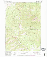
1972 Map of Canyon Mtn
USGS Topo · Published 1995About this map
Canyon Creek carves through the heart of the Malheur National Forest in this early 1970s survey, illustrating a landscape defined by resource extraction and rugged topography. The presence of Dredge Tailings near Cherry Gulch and a cluster of hard-rock operations like the Golden West Mine, Iron King Mine, and Great Northern Mine point to a history of mineral pursuit within the Strawberry Range. This era of the forest is also marked by recreational and seasonal development, shown through sites such as Ray Cole Campground and Jack Cabin Meadow.
Find a feature on this map
62 named features on this map. Tap any name to fly to it.
Don’t see what you’re looking for? This feature index may not catch every label — zoom into the map to look around manually.
Map Details
Editions of this 1972 Canyon Mtn Map
3 editions found
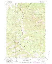
Other maps of this area

1940 · Mount Vernon
USGS Topo · 1:62,500

1940 · John Day
USGS Topo · 1:62,500

1943 · John Day
USGS Topo · 1:62,500

1943 · Mount Vernon
USGS Topo · 1:62,500

1955 · Canyon City
USGS Topo · 1:250,000

1959 · Canyon City
USGS Topo · 1:250,000

1961 · Logdell
USGS Topo · 1:62,500

1961 · Seneca
USGS Topo · 1:62,500

1972 · John Day
USGS Topo · 1:24,000

1972 · Canyon Mtn
USGS Topo · 1:24,000