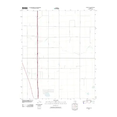
2010 Map of Canyon SE
USGS Topo · Published 2010About this map
South Cita Creek meanders through this portion of the Texas Panhandle, providing a natural break in the geometric grid of Randall County. The landscape is defined by a rigorous network of section-line roads, such as Lawrence Rd and S Georgia St, which reflect the region's agricultural development and land division. While primarily rural and open, the map shows the incremental southward expansion of the suburban grid with residential streets and cul-de-sacs appearing near Tradewind St. The interplay between the natural course of the creek and the rigid man-made thoroughfares like Osage St and S Grand Rd illustrates the 21st-century transition of the High Plains from traditional ranching and farming to more dense development.
Find a feature on this map
13 named features on this map. Tap any name to fly to it.
Don’t see what you’re looking for? This feature index may not catch every label — zoom into the map to look around manually.
Map Details
Editions of this 2010 Canyon SE Map
This is the sole edition of this map. No revisions or reprints were ever made.
Other maps of this area

1954 · Plainview
USGS Topo · 1:250,000

1956 · Fortress Cliff
USGS Topo · 1:24,000

1958 · Plainview
USGS Topo · 1:250,000

1960 · Canyon
USGS Topo · 1:62,500

1960 · Wayside
USGS Topo · 1:62,500

1965 · Happy
USGS Topo · 1:24,000

1966 · Tulia NW
USGS Topo · 1:24,000

1969 · Tule Lake NW
USGS Topo · 1:24,000
1984 · Canyon
USGS Topo · 1:24,000
1984 · Ogg
USGS Topo · 1:24,000