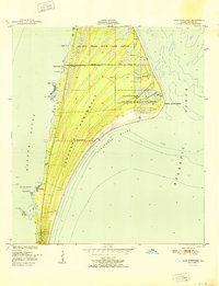
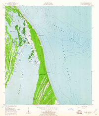
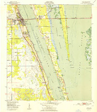
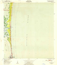
1951 Map of Cape Canaveral
USGS Topo · Published 1971About this map
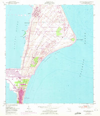
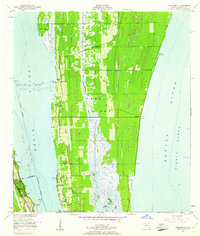
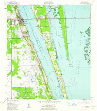
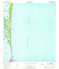
The Cape Kennedy Air Force Station (NASA) dominates this coastal landscape, showing the rapid development of the space program during the mid-20th century. Originally surveyed in 1948 and updated with 1970 aerial photography, the map documents a dense network of early aerospace infrastructure including Launch Complex 17, Launch Complex 26, and the CKAFS Industrial area. The Cape Canaveral Lighthouse and a Lookout Tower stand as older navigational landmarks on the Cape Kennedy shoreline, overlooking the Canaveral Bight. To the south, the settlement of Cape Canaveral shows its expansion near the Barge Canal and Turning Basin. This record captures a pivotal transition, as quiet coastal features like Quarterman Cove and the small community at Holmes were eclipsed by massive launch facilities and a long Runway.
Find a feature on this map
45 named features on this map. Tap any name to fly to it.
Don’t see what you’re looking for? This feature index may not catch every label — zoom into the map to look around manually.
Map Details
Editions of this 1951 Cape Canaveral Map
3 editions found
Other maps of this area
1949 · Orsino
USGS Topo · 1:24,000
1949 · False Cape
USGS Topo · 1:24,000
1949 · Courtenay
USGS Topo · 1:24,000
1949 · Cocoa
USGS Topo · 1:24,000
1949 · Cocoa Beach
USGS Topo · 1:24,000

1951 · False Cape
USGS Topo · 1:24,000
1951 · Cocoa
USGS Topo · 1:24,000

1951 · Courtenay
USGS Topo · 1:24,000
1951 · Cocoa Beach
USGS Topo · 1:24,000

1951 · Orsino
USGS Topo · 1:24,000