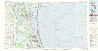
1981 Map of Cape Canaveral
USGS Topo · Published 1983About this map
John F Kennedy Space Center (NASA) and the Cape Canaveral Air Force Station dominate the barrier island landscape of Brevard County in the early 1980s. This survey illustrates the dense concentration of aerospace and military infrastructure alongside expansive conservation areas like the Merritt Island National Wildlife Refuge and the Tosohatchee State Preserve. The coastal corridor is highly developed, showing a continuous string of beach communities from Cocoa Beach down to Melbourne Beach, separated from the mainland by the Banana River and Indian River.
Find a feature on this map
71 named features on this map. Tap any name to fly to it.
Don’t see what you’re looking for? This feature index may not catch every label — zoom into the map to look around manually.
Map Details
Editions of this 1981 Cape Canaveral Map
This is the sole edition of this map. No revisions or reprints were ever made.
Other maps of this area

1949 · Melbourne West
USGS Topo · 1:24,000

1949 · Orsino
USGS Topo · 1:24,000

1949 · Melbourne East
USGS Topo · 1:24,000

1949 · False Cape
USGS Topo · 1:24,000

1949 · Sebastian NW
USGS Topo · 1:24,000

1949 · Titusville
USGS Topo · 1:24,000

1949 · Courtenay
USGS Topo · 1:24,000

1949 · Eau Gallie
USGS Topo · 1:24,000

1949 · Sharpes
USGS Topo · 1:24,000

1949 · Cocoa
USGS Topo · 1:24,000