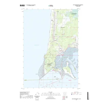
2020 Map of Cape Disappointment
USGS Topo · Published 2020About this map
Cape Disappointment anchors this coastal survey, where the Columbia River meets the Pacific Ocean at the treacherous entrance to Baker Bay. The landscape is a complex intersection of maritime history and modern conservation, featuring the grounds of Fort Canby and the sprawling Lewis and Clark National Historical Park. Along the Long Beach Peninsula, a string of historic communities including Long Beach, Seaview, and Ilwaco are connected by the Discovery Trail and Pacific Avenue. The map captures the delicate balance between active infrastructure, such as the Port of Ilwaco Airport, and protected wetlands like the Willapa National Wildlife Refuge. Researchers can trace the narrow-gauge heritage near Holman or locate family sites at Ilwaco Cemetery and Lone Fir Cemetery near the northern marshes of Tarlatt Slough.
Find a feature on this map
74 named features on this map. Tap any name to fly to it.
Don’t see what you’re looking for? This feature index may not catch every label — zoom into the map to look around manually.
Map Details
Editions of this 2020 Cape Disappointment Map
This is the sole edition of this map. No revisions or reprints were ever made.
Other maps of this area

1919 · Astoria
USGS Topo · 1:62,500

1938 · Cape Disappointment
USGS Topo · 1:62,500

1938 · Fort Columbia
USGS Topo · 1:62,500

1939 · Astoria
USGS Topo · 1:62,500

1943 · Fort Columbia
USGS Topo · 1:62,500

1943 · Copalis Beach
USGS Topo · 1:250,000

1949 · Chinook
USGS Topo · 1:24,000

1949 · Ocean Park
USGS Topo · 1:24,000

1949 · Long Island
USGS Topo · 1:24,000
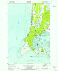
1949 · Cape Disappointment
USGS Topo · 1:24,000