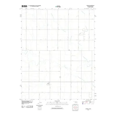
2010 Map of Capron
USGS Topo · Published 2010About this map
Capron stands as a quiet agricultural hub along the Oklahoma-Kansas border, defined by a rigid grid of rural roads and the winding path of Driftwood Creek. The landscape is etched by a drainage network that includes Little Driftwood Creek and Dry Creek, illustrating the plains hydrology that shaped local ranching and farming. Evidence of the region's rail-dependent history is found at Loder Siding, which points to a time when wheat and livestock transport relied on trackside infrastructure. Genealogy researchers will find value in the location of the Capron Cemetery, situated north of the main settlement. The survey illustrates the intersection of natural waterways like Little Mule Creek with the straight-line section roads that dominate Woods County, reflecting the orderly expansion of the High Plains during the twentieth century.
Find a feature on this map
23 named features on this map. Tap any name to fly to it.
Don’t see what you’re looking for? This feature index may not catch every label — zoom into the map to look around manually.
Map Details
Editions of this 2010 Capron Map
This is the sole edition of this map. No revisions or reprints were ever made.
Other maps of this area

1889 · Anthony
USGS Topo · 1:125,000

1891 · Medicine Lodge
USGS Topo · 1:125,000

1891 · Anthony
USGS Topo · 1:125,000

1893 · Medicine Lodge
USGS Topo · 1:125,000

1955 · Woodward
USGS Topo · 1:250,000

1955 · Pratt
USGS Topo · 1:250,000

1958 · Woodward
USGS Topo · 1:250,000

1959 · Pratt
USGS Topo · 1:250,000

1968 · Capron
USGS Topo · 1:24,000

1969 · Alva SE
USGS Topo · 1:24,000