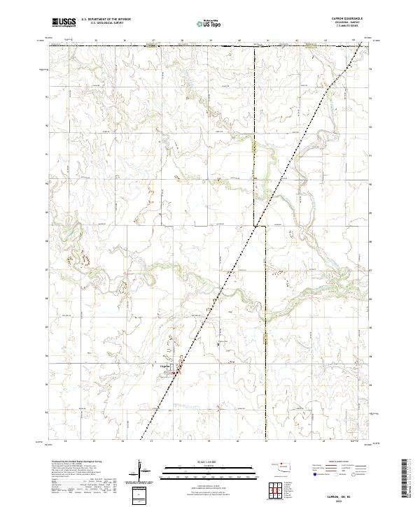
2022 Map of Capron
USGS Topo · Published 2022About this map
Capron sits as the central settlement in this borderland landscape where the Oklahoma-Kansas state line divides the plains. Located in Woods Co, the town is oriented along Grant St and surrounded by a vast grid of section roads including Leflore Rd and Kiowa Rd. The terrain is defined by the dendritic drainage patterns of Driftwood Cr, Little Driftwood Cr, and Little Mule Cr, which cut through the agricultural sections. For those researching local family history, the Capron Cem is a primary landmark located just north of the main settlement. The geography here is remarkably transitionary, as the map tracks the boundary where Barber Co, Kansas, meets Woods Co and Alfalfa Co, Oklahoma, along the prominent Stateline Rd.
Find a feature on this map
41 named features on this map. Tap any name to fly to it.
Don’t see what you’re looking for? This feature index may not catch every label — zoom into the map to look around manually.
Map Details
Editions of this 2022 Capron Map
This is the sole edition of this map. No revisions or reprints were ever made.
Other maps of this area

1889 · Anthony
USGS Topo · 1:125,000

1891 · Medicine Lodge
USGS Topo · 1:125,000

1891 · Anthony
USGS Topo · 1:125,000

1893 · Medicine Lodge
USGS Topo · 1:125,000

1955 · Woodward
USGS Topo · 1:250,000

1955 · Pratt
USGS Topo · 1:250,000

1958 · Woodward
USGS Topo · 1:250,000

1959 · Pratt
USGS Topo · 1:250,000

1968 · Capron
USGS Topo · 1:24,000

1969 · Alva SE
USGS Topo · 1:24,000