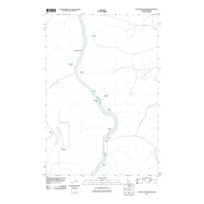
2011 Map of Captain John Rapids
USGS Topo · Published 2011About this map
The Snake River carves a deep path through this borderland, where the water’s power is marked by Buffalo Rapids and the namesake Captain John Rapids. Settlement patterns follow the river and the steep drainage draws, with Grahams Landing and Taplin serving as focal points for activity along the banks. The landscape is defined by its verticality, seen in the numerous gulches and canyons like Crowers Canyon and Gilmore Gulch that terrace down toward the water.
Find a feature on this map
31 named features on this map. Tap any name to fly to it.
Don’t see what you’re looking for? This feature index may not catch every label — zoom into the map to look around manually.
Map Details
Editions of this 2011 Captain John Rapids Map
This is the sole edition of this map. No revisions or reprints were ever made.
Other maps of this area

1944 · Anatone
USGS Topo · 1:62,500

1945 · Clarkston
USGS Topo · 1:62,500

1946 · Limekiln Rapids
USGS Topo · 1:62,500

1946 · Anatone
USGS Topo · 1:62,500

1948 · Clarkston
USGS Topo · 1:62,500

1955 · Pullman
USGS Topo · 1:250,000

1958 · Pullman
USGS Topo · 1:250,000

1958 · Sweetwater
USGS Topo · 1:24,000

1958 · Lewiston Orchards South
USGS Topo · 1:24,000

1958 · Lewiston Orchards
USGS Topo · 1:62,500