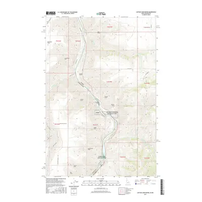
2017 Map of Captain John Rapids
USGS Topo · Published 2017About this map
The Snake River carves a deep boundary between Washington and Idaho on this quadrangle, serving as the central artery for a landscape defined by dramatic elevation changes. Along its banks, the Nez Perce National Historical Park and the Lyons Ferry Fish Hatchery represent significant cultural and conservation efforts in the region. The river's path is marked by challenging water features such as Captain John Rapids and Buffalo Rapids, which historically dictated river navigation and transport patterns.
Find a feature on this map
44 named features on this map. Tap any name to fly to it.
Don’t see what you’re looking for? This feature index may not catch every label — zoom into the map to look around manually.
Map Details
Editions of this 2017 Captain John Rapids Map
This is the sole edition of this map. No revisions or reprints were ever made.
Other maps of this area

1944 · Anatone
USGS Topo · 1:62,500

1945 · Clarkston
USGS Topo · 1:62,500

1946 · Limekiln Rapids
USGS Topo · 1:62,500

1946 · Anatone
USGS Topo · 1:62,500

1948 · Clarkston
USGS Topo · 1:62,500

1955 · Pullman
USGS Topo · 1:250,000

1958 · Pullman
USGS Topo · 1:250,000

1958 · Sweetwater
USGS Topo · 1:24,000

1958 · Lewiston Orchards South
USGS Topo · 1:24,000

1958 · Lewiston Orchards
USGS Topo · 1:62,500