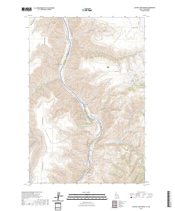
2024 Map of Captain John Rapids
USGS Topo · Published 2024About this map
The Snake Wild and Scenic River carves a deep path through this borderland, where the Asotin and Nez Perce county line meets the state boundary between Washington and Idaho. This 2024 landscape is defined by the dramatic descent from high plateaus like Montgomery Ridge and Weissenfels Ridge down to the riverbank. Protected lands are prominent along the Idaho side, notably the Nez Perce National Historical Park and the Lyons Ferry Fish Hatchery located near Bobcat Bar.
Find a feature on this map
46 named features on this map. Tap any name to fly to it.
Don’t see what you’re looking for? This feature index may not catch every label — zoom into the map to look around manually.
Map Details
Editions of this 2024 Captain John Rapids Map
This is the sole edition of this map. No revisions or reprints were ever made.
Other maps of this area

1944 · Anatone
USGS Topo · 1:62,500

1945 · Clarkston
USGS Topo · 1:62,500

1946 · Limekiln Rapids
USGS Topo · 1:62,500

1946 · Anatone
USGS Topo · 1:62,500

1948 · Clarkston
USGS Topo · 1:62,500

1955 · Pullman
USGS Topo · 1:250,000

1958 · Pullman
USGS Topo · 1:250,000

1958 · Sweetwater
USGS Topo · 1:24,000

1958 · Lewiston Orchards South
USGS Topo · 1:24,000

1958 · Lewiston Orchards
USGS Topo · 1:62,500