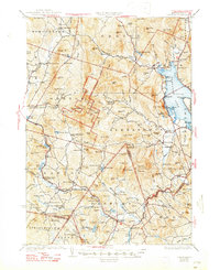
1930 Map of Cardigan
USGS Topo · Published 1947About this map
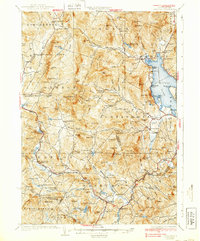
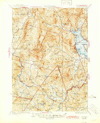
The granite peaks and upland basins of the Mt Cardigan massif dominate this landscape during the late 1920s, a period when the Cardigan State Forest was establishing its footprint in the White Mountain foothills. The rugged interior is marked by isolated rural outposts like the Story Sch and Wild Meadow Sch, reflecting a high-elevation township structure before the consolidation of rural districts. The eastern edge of the sheet centers on the clear waters of Newfound Lake, where recreational landmarks like Nutting Beach and Whittemore Point began to define the shoreline's character.
Find a feature on this map
147 named features on this map. Tap any name to fly to it.
Don’t see what you’re looking for? This feature index may not catch every label — zoom into the map to look around manually.
Map Details
Editions of this 1930 Cardigan Map
7 editions found

Other maps of this area

1902 · Sunapee
USGS Topo · 1:62,500

1905 · Sunapee
USGS Topo · 1:62,500

1907 · Sunapee
USGS Topo · 1:62,500

1925 · Holderness
USGS Topo · 1:62,500

1927 · Penacook
USGS Topo · 1:62,500

1927 · Holderness
USGS Topo · 1:62,500

1927 · Cardigan
USGS Topo · 1:62,500

1927 · Mascoma
USGS Topo · 1:62,500

1928 · Mount Kearsarge
USGS Topo · 1:62,500

1928 · Plymouth
USGS Topo · 1:62,500