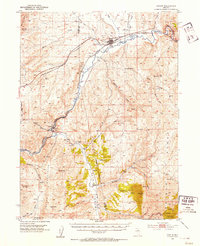
1952 Map of Carlin
USGS Topo · Published 1954About this map
The Humboldt River corridor serves as the primary artery for transportation and settlement in this portion of the Great Basin, where the tracks of the Southern Pacific and Western Pacific railroads parallel the water's path. The town of Carlin is the central hub of activity, featuring industrial infrastructure like a Water Tank and Sewage Disposal facility. To the southwest, the steep topography of the Cortez Mountains overlooks the narrow passage at Palisade, a site marked by tunnels and a cemetery.
Find a feature on this map
50 named features on this map. Tap any name to fly to it.
Don’t see what you’re looking for? This feature index may not catch every label — zoom into the map to look around manually.
Map Details
Editions of this 1952 Carlin Map
5 editions found
Other maps of this area

1934 · Jiggs
USGS Topo · 1:125,000

1937 · Jiggs
USGS Topo · 1:125,000

1952 · Dixie Flats
USGS Topo · 1:62,500

1952 · Pine Valley
USGS Topo · 1:62,500

1952 · Carlin
USGS Topo · 1:62,500

1955 · Winnemucca
USGS Topo · 1:250,000

1955 · Elko
USGS Topo · 1:250,000

1956 · Robinson Mtn
USGS Topo · 1:62,500

1957 · Frenchie Creek
USGS Topo · 1:62,500

1957 · Beowawe
USGS Topo · 1:62,500