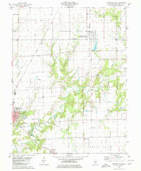
1979 Map of Carlinville East
USGS Topo · Published 1980About this map
Carlinville and its eastern agricultural hinterlands are the focus of this late-1970s study, revealing a landscape where institutional landmarks and transport corridors meet. The western edge is defined by the campus of Blackburn College and the active community hub at the Fairground, while the city's growth is marked by New Calvary Cem and Mayfield Memorial Park. To the north, Standard City sits along a dense network of transit lines, including the Gulf Mobile And Ohio and the Illinois Terminal route.
Find a feature on this map
44 named features on this map. Tap any name to fly to it.
Don’t see what you’re looking for? This feature index may not catch every label — zoom into the map to look around manually.
Map Details
Editions of this 1979 Carlinville East Map
2 editions found
Other maps of this area

1912 · Gillespie
USGS Topo · 1:62,500

1915 · Gillespie
USGS Topo · 1:62,500

1915 · Mount Olive
USGS Topo · 1:62,500

1923 · Carlinville
USGS Topo · 1:48,000

1923 · Raymond
USGS Topo · 1:62,500

1925 · Carlinville
USGS Topo · 1:62,500

1925 · Raymond
USGS Topo · 1:62,500

1931 · Carlinville
USGS Topo · 1:62,500

1944 · Mount Olive
USGS Topo · 1:62,500

1958 · Decatur
USGS Topo · 1:250,000