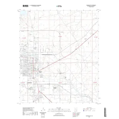
2020 Map of Carlsbad East
USGS Topo · Published 2020About this map
Carlsbad serves as the focal point of this 2020 study, revealing a dense network of neighborhoods and industrial infrastructure east of the city center. The Pecos River carves a path through the landscape, flanked by distinctive natural features like Wildcat Bluff and Telltale Bluffs. Settlement patterns are clearly defined, showing the proximity of Hagerman Heights, San Jose, and La Huerta to the river's edge.
Find a feature on this map
102 named features on this map. Tap any name to fly to it.
Don’t see what you’re looking for? This feature index may not catch every label — zoom into the map to look around manually.
Map Details
Editions of this 2020 Carlsbad East Map
This is the sole edition of this map. No revisions or reprints were ever made.
Other maps of this area

1939 · Carlsbad
USGS Topo · 1:62,500

1943 · Carlsbad
USGS Topo · 1:62,500

1943 · Oil City
USGS Topo · 1:62,500

1943 · West Carlsbad
USGS Topo · 1:62,500

1945 · West Carlsbad
USGS Topo · 1:62,500

1954 · Carlsbad
USGS Topo · 1:250,000

1955 · Lake Mc Millan South
USGS Topo · 1:24,000

1958 · Carlsbad
USGS Topo · 1:250,000

1978 · Artesia
USGS Topo · 1:100,000
1979 · Carlsbad
USGS Topo · 1:100,000