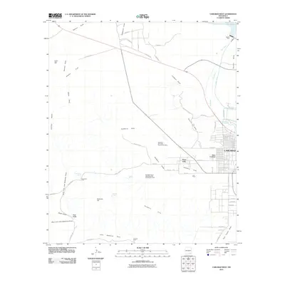
2010 Map of Carlsbad West
USGS Topo · Published 2010About this map
Living Desert State Park sits at the heart of this transition between the city and the high desert plateaus of the Azotea Mesa. The landscape is defined by the critical management of water in an arid environment, featuring the Pecos River feeding into the Main Canal and East Canal systems. Significant infrastructure like the Avalon Dam at Lake Avalon and various flood control structures, such as the Hackberry Draw Site Number One Dam, illustrate the engineering required to sustain settlements like West Carlsbad and the residential community of Happy Valley. To the west, the terrain becomes more isolated, dotted with family-named holdings including the Frank Jones Ranch and Lassiter Ranch, alongside industrial markers like the Golden Eagle Mine. This area preserves a record of ranching life and mineral exploration at the edge of the Ocotillo Hills.
Find a feature on this map
61 named features on this map. Tap any name to fly to it.
Don’t see what you’re looking for? This feature index may not catch every label — zoom into the map to look around manually.
Map Details
Editions of this 2010 Carlsbad West Map
This is the sole edition of this map. No revisions or reprints were ever made.
Other maps of this area

1939 · Carlsbad
USGS Topo · 1:62,500

1943 · Carlsbad
USGS Topo · 1:62,500

1943 · Oil City
USGS Topo · 1:62,500

1943 · West Carlsbad
USGS Topo · 1:62,500

1945 · West Carlsbad
USGS Topo · 1:62,500

1954 · Seven Rivers
USGS Topo · 1:24,000

1954 · Carlsbad
USGS Topo · 1:250,000

1955 · Lake Mc Millan South
USGS Topo · 1:24,000

1958 · Carlsbad
USGS Topo · 1:250,000

1978 · Artesia
USGS Topo · 1:100,000