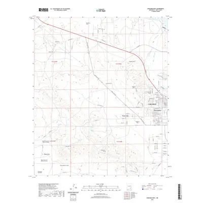
2020 Map of Carlsbad West
USGS Topo · Published 2020About this map
The Pecos River valley and the eastern slopes of the Guadalupe Mountains define this landscape as it appeared in the early 21st century. The city of Carlsbad is the primary hub, with established neighborhoods like West Carlsbad and the growing residential area of Happy Valley flanking the central district. Significant water management infrastructure is evident through the Main Canal and E Canal, which draw from the river to support this arid region.
Find a feature on this map
109 named features on this map. Tap any name to fly to it.
Don’t see what you’re looking for? This feature index may not catch every label — zoom into the map to look around manually.
Map Details
Editions of this 2020 Carlsbad West Map
This is the sole edition of this map. No revisions or reprints were ever made.
Other maps of this area

1939 · Carlsbad
USGS Topo · 1:62,500

1943 · Carlsbad
USGS Topo · 1:62,500

1943 · Oil City
USGS Topo · 1:62,500

1943 · West Carlsbad
USGS Topo · 1:62,500

1945 · West Carlsbad
USGS Topo · 1:62,500

1954 · Seven Rivers
USGS Topo · 1:24,000

1954 · Carlsbad
USGS Topo · 1:250,000

1955 · Lake Mc Millan South
USGS Topo · 1:24,000

1958 · Carlsbad
USGS Topo · 1:250,000

1978 · Artesia
USGS Topo · 1:100,000