
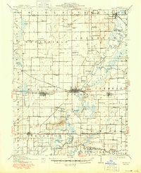
1910 Map of Carlyle
USGS Topo · Published 1910About this map
The Kaskaskia River meanders through Clinton County, anchoring a landscape defined by its early rail lines and agricultural townships. This 1910 survey highlights the prominence of the Baltimore and Ohio Southwestern railroad as it cuts through Carlyle and Beckemeyer, while the Southern and Louisville and St Louis Line serve the southern reaches. The map reveals an intricate network of rural infrastructure, from the Colmers Ferry crossing the river to the abundance of small schoolhouses like Schwierjohn School and Matsler School that served isolated farming families.
Find a feature on this map
96 named features on this map. Tap any name to fly to it.
Don’t see what you’re looking for? This feature index may not catch every label — zoom into the map to look around manually.
Map Details
Editions of this 1910 Carlyle Map
2 editions found
Other maps of this area

1906 · Breese
USGS Topo · 1:62,500

1907 · Breese
USGS Topo · 1:62,500

1910 · Okawville
USGS Topo · 1:62,500

1914 · Centralia
USGS Topo · 1:62,500

1931 · Hoyleton
USGS Topo · 1:48,000

1932 · Greenville
USGS Topo · 1:62,500

1932 · Nashville
USGS Topo · 1:62,500

1935 · Centralia
USGS Topo · 1:62,500

1936 · Nashville
USGS Topo · 1:62,500

1937 · New Douglas
USGS Topo · 1:48,000