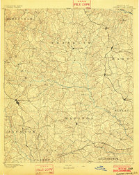
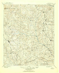
1891 Map of Carnesville
USGS Topo · Published 1902About this map
Carnesville and the surrounding Georgia Piedmont were characterized by a dense network of small agricultural settlements and river crossings in the years following the Reconstruction era. This survey, conducted by Gilbert Thompson and M. Hackett, captures a landscape defined by its reliance on water power and early rail transport. Notable river crossings such as Bragg Fy. and Daniel Fy. provided critical links across the Broad River and its many tributaries, including the Hudson River and Big Bluestone Creek.
Find a feature on this map
87 named features on this map. Tap any name to fly to it.
Don’t see what you’re looking for? This feature index may not catch every label — zoom into the map to look around manually.
Map Details
Editions of this 1891 Carnesville Map
6 editions found
Other maps of this area

1886 · Dahlonega
USGS Topo · 1:125,000

1886 · Walhalla
USGS Topo · 1:125,000

1888 · Pickens
USGS Topo · 1:125,000

1891 · Gainesville
USGS Topo · 1:125,000

1891 · Carnesville
USGS Topo · 1:125,000

1892 · Dahlonega
USGS Topo · 1:125,000

1892 · Walhalla
USGS Topo · 1:125,000

1893 · Elberton
USGS Topo · 1:125,000

1894 · Pickens
USGS Topo · 1:125,000

1896 · Walhalla
USGS Topo · 1:125,000