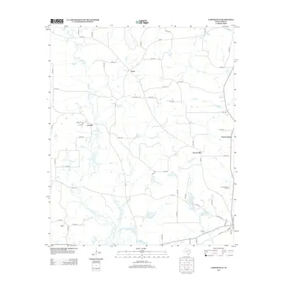
2013 Map of Carterville
USGS Topo · Published 2013About this map
Carterville and its surrounding rural landscapes in Cass County are defined by a complex network of waterways and small family settlements. Low-lying drainages like Pigeon Roost Cr and Flat Cr wind through the terrain, punctuated by several managed bodies of water such as Linden Club Lake, Skelton Lake, and George Wesley Morse Lake. These reservoirs and the surrounding creek bottoms illustrate the importance of water management in this portion of Northeast Texas.
Find a feature on this map
72 named features on this map. Tap any name to fly to it.
Don’t see what you’re looking for? This feature index may not catch every label — zoom into the map to look around manually.
Map Details
Editions of this 2013 Carterville Map
This is the sole edition of this map. No revisions or reprints were ever made.
Other maps of this area

1910 · Linden
USGS Topo · 1:62,500

1914 · Daingerfield
USGS Topo · 1:62,500

1953 · Texarkana
USGS Topo · 1:250,000

1956 · Texarkana
USGS Topo · 1:250,000

1956 · Tyler
USGS Topo · 1:250,000

1961 · Cunningham Creek
USGS Topo · 1:24,000

1962 · Lanier
USGS Topo · 1:24,000

1962 · Avinger
USGS Topo · 1:24,000

1965 · Marietta
USGS Topo · 1:24,000
1965 · Sardis
USGS Topo · 1:24,000