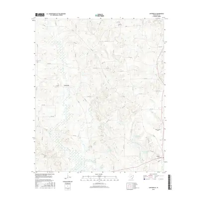
2016 Map of Carterville
USGS Topo · Published 2016About this map
Linden and the smaller community of Carterville anchor this 2016 survey of the East Texas landscape in Cass County. The area is defined by a dense network of watercourses, including Mill Cr and Jim Bayou, which feed into several small reservoirs such as George Wesley Morse Lake and Linden Club Lake. These water bodies and the surrounding creek bottoms suggest a terrain historically shaped by timber and agriculture, with numerous county roads like Co RD 1241 and Co RD 1462 providing access to family lands and remote acreage.
Find a feature on this map
64 named features on this map. Tap any name to fly to it.
Don’t see what you’re looking for? This feature index may not catch every label — zoom into the map to look around manually.
Map Details
Editions of this 2016 Carterville Map
This is the sole edition of this map. No revisions or reprints were ever made.
Other maps of this area

1910 · Linden
USGS Topo · 1:62,500

1914 · Daingerfield
USGS Topo · 1:62,500

1953 · Texarkana
USGS Topo · 1:250,000

1956 · Texarkana
USGS Topo · 1:250,000

1956 · Tyler
USGS Topo · 1:250,000

1961 · Cunningham Creek
USGS Topo · 1:24,000

1962 · Lanier
USGS Topo · 1:24,000

1962 · Avinger
USGS Topo · 1:24,000

1965 · Marietta
USGS Topo · 1:24,000
1965 · Sardis
USGS Topo · 1:24,000