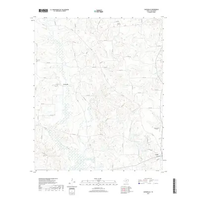
2019 Map of Carterville
USGS Topo · Published 2019About this map
The town of Linden sits at the southeastern edge of this landscape, where local roads like W Houston St and Grubbs St mark the residential limits. The terrain to the north and west is defined by a dense network of creek drainages, including Flat Cr and Mill Cr, which feed into several small impoundments such as Skelton Lake and George Wesley Morse Lake. This area of Cass County maintains a predominantly rural character, anchored by the settlement of Carterville and connected by a web of county roads and farm-to-market routes like FM 1399.
Find a feature on this map
64 named features on this map. Tap any name to fly to it.
Don’t see what you’re looking for? This feature index may not catch every label — zoom into the map to look around manually.
Map Details
Editions of this 2019 Carterville Map
This is the sole edition of this map. No revisions or reprints were ever made.
Other maps of this area

1910 · Linden
USGS Topo · 1:62,500

1914 · Daingerfield
USGS Topo · 1:62,500

1953 · Texarkana
USGS Topo · 1:250,000

1956 · Texarkana
USGS Topo · 1:250,000

1956 · Tyler
USGS Topo · 1:250,000

1961 · Cunningham Creek
USGS Topo · 1:24,000

1962 · Lanier
USGS Topo · 1:24,000

1962 · Avinger
USGS Topo · 1:24,000

1965 · Marietta
USGS Topo · 1:24,000
1965 · Sardis
USGS Topo · 1:24,000