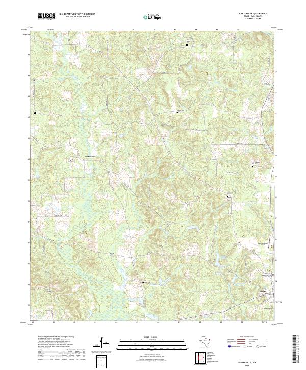
2022 Map of Carterville
USGS Topo · Published 2022About this map
Linden anchors the southeastern corner of this East Texas survey, where the Cass County Law Enforcement and Justice Center stands as a modern landmark. The terrain is defined by a dense network of winding creeks and branches, including the prominent Flat Cr and Mill Cr, which carve through the wooded landscape toward larger bodies of water like George Wesley Morse Lake and Linden Club Lake. These waterways have historically shaped the settlement patterns of the region, visible in the cluster of burial grounds and small communities that dot the map.
Find a feature on this map
73 named features on this map. Tap any name to fly to it.
Don’t see what you’re looking for? This feature index may not catch every label — zoom into the map to look around manually.
Map Details
Editions of this 2022 Carterville Map
This is the sole edition of this map. No revisions or reprints were ever made.
Other maps of this area

1910 · Linden
USGS Topo · 1:62,500

1914 · Daingerfield
USGS Topo · 1:62,500

1953 · Texarkana
USGS Topo · 1:250,000

1956 · Texarkana
USGS Topo · 1:250,000

1956 · Tyler
USGS Topo · 1:250,000

1961 · Cunningham Creek
USGS Topo · 1:24,000

1962 · Lanier
USGS Topo · 1:24,000

1962 · Avinger
USGS Topo · 1:24,000

1965 · Marietta
USGS Topo · 1:24,000
1965 · Sardis
USGS Topo · 1:24,000