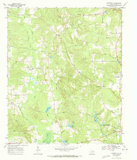
1969 Map of Carterville
USGS Topo · Published 1973About this map
The wooded hills of Cass County are defined by a network of small creeks and scattered rural settlements as they appeared in the late 1960s. Central to the landscape is the Old Railroad Grade, which snakes through the western portion of the map past the settlement of Carterville. This corridor reflects the transition from timber and rail dominance to a more dispersed agricultural and community-focused layout. The area around the county seat at Linden shows early suburban growth and recreational development, highlighted by George Wesley Morse Lake and Linden Club Lake. Genealogists and local historians can pinpoint numerous rural landmarks, including Bethel-Cass Ch, Mill Creek Ch, and family-oriented burial grounds like Boon Cem and Hickory Grove Cem. The presence of a Strip Mine and various gravel pits near Warren Springs indicates the persistent small-scale extraction industries that shaped the local economy alongside the winding courses of Mill Creek and Roost Creek.
Find a feature on this map
33 named features on this map. Tap any name to fly to it.
Don’t see what you’re looking for? This feature index may not catch every label — zoom into the map to look around manually.
Map Details
Editions of this 1969 Carterville Map
This is the sole edition of this map. No revisions or reprints were ever made.
Other maps of this area

1910 · Linden
USGS Topo · 1:62,500

1914 · Daingerfield
USGS Topo · 1:62,500

1953 · Texarkana
USGS Topo · 1:250,000

1956 · Texarkana
USGS Topo · 1:250,000

1956 · Tyler
USGS Topo · 1:250,000

1961 · Cunningham Creek
USGS Topo · 1:24,000

1962 · Lanier
USGS Topo · 1:24,000

1962 · Avinger
USGS Topo · 1:24,000

1965 · Marietta
USGS Topo · 1:24,000
1965 · Sardis
USGS Topo · 1:24,000