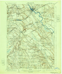
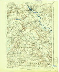
1904 Map of Carthage
USGS Topo · Published 1932About this map
Industrial nodes and riverside hamlets define this early 20th-century landscape along the Black River valley. The twin communities of Carthage and West Carthage anchor the north, where the New York Central and Hudson River R. R. follows the river's path through the fertile Jefferson and Lewis County borderlands. The terrain transitions from the water-powered industrial sites at High Falls and Kings Falls to the agricultural plateaus of Denmark and Harrisburg.
Find a feature on this map
46 named features on this map. Tap any name to fly to it.
Don’t see what you’re looking for? This feature index may not catch every label — zoom into the map to look around manually.
Map Details
Editions of this 1904 Carthage Map
6 editions found
Other maps of this area

1895 · Watertown
USGS Topo · 1:62,500

1898 · Watertown
USGS Topo · 1:62,500

1902 · Carthage
USGS Topo · 1:62,500

1903 · Theresa
USGS Topo · 1:62,500

1903 · Orwell
USGS Topo · 1:62,500

1904 · Carthage
USGS Topo · 1:62,500

1905 · Orwell
USGS Topo · 1:62,500

1905 · Port Leyden
USGS Topo · 1:62,500

1906 · Highmarket
USGS Topo · 1:62,500

1907 · Port Leyden
USGS Topo · 1:62,500