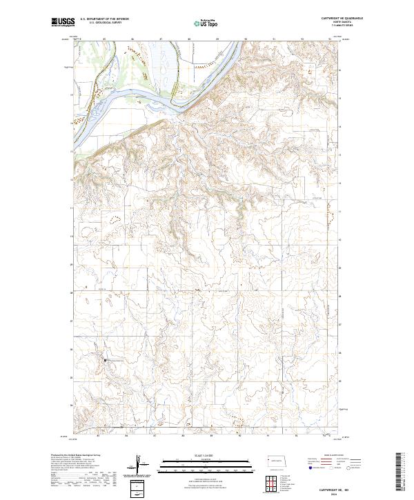
2024 Map of Cartwright NE
USGS Topo · Published 2024About this map
The Missouri River carves a significant path through the northern portion of this landscape, marking the boundary between McKenzie and Williams Counties. This rural expanse in western North Dakota is defined by the sharp transition from the river bottomlands to the dissected plateaus of the Missouri badlands. A key historical and genealogical marker on the sheet is the Yellowstone Point Cem, located in the southwest quadrant near the headwaters of local drainages. The area is interlaced with a grid of section roads and rural routes, such as Co Rd 16 and 147th Rd NW, which provide access to the high ground overlooking the Sixmile Creek drainage. The land pattern reflects the large-scale ranching and agricultural operations typical of the Missouri River breaks, where the topography often dictates the placement of infrastructure away from the steeper coulees.
Find a feature on this map
19 named features on this map. Tap any name to fly to it.
Don’t see what you’re looking for? This feature index may not catch every label — zoom into the map to look around manually.
Map Details
Editions of this 2024 Cartwright NE Map
This is the sole edition of this map. No revisions or reprints were ever made.
Other maps of this area

1953 · Williston
USGS Topo · 1:250,000

1953 · Watford City
USGS Topo · 1:250,000

1957 · Williston
USGS Topo · 1:250,000

1957 · Watford City
USGS Topo · 1:250,000

1967 · Watford City
USGS Topo · 1:250,000

1968 · Trenton SW
USGS Topo · 1:24,000
1968 · Buford
USGS Topo · 1:24,000

1969 · Trenton
USGS Topo · 1:24,000

1969 · Cartwright NE
USGS Topo · 1:24,000

1972 · Alexander
USGS Topo · 1:24,000