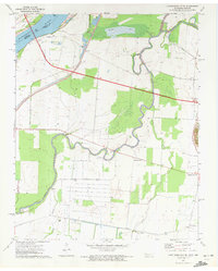
1971 Map of Caruthersville SE
USGS Topo · Published 1972About this map
The Mississippi River forms a shifting boundary between Missouri and Tennessee in this riverine landscape, where the Obion River meanders through low-lying bottomlands. Small rural communities like Boothspoint, Mengelwood, and Tylersville are linked by a developing road network, including a major highway noted as Under Construction during the early 1970s. The region’s hydrology is defined by complex drainage patterns, with Running Reelfoot Bayou and Rush Slough cutting through the floodplain.
Find a feature on this map
20 named features on this map. Tap any name to fly to it.
Don’t see what you’re looking for? This feature index may not catch every label — zoom into the map to look around manually.
Map Details
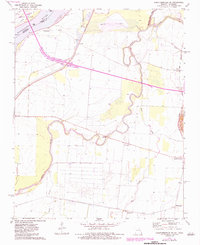
Editions of this 1971 Caruthersville SE Map
2 editions found
Other maps of this area

1939 · Dyersburg
USGS Topo · 1:62,500

1939 · Hales Point
USGS Topo · 1:62,500

1939 · Caruthersville
USGS Topo · 1:62,500

1939 · Halls
USGS Topo · 1:62,500

1951 · Caruthersville
USGS Topo · 1:62,500

1952 · Hales Point
USGS Topo · 1:62,500

1952 · Dyersburg
USGS Topo · 1:24,000

1952 · Miston
USGS Topo · 1:24,000

1952 · Fowlkes
USGS Topo · 1:24,000

1956 · Dyersburg
USGS Topo · 1:250,000