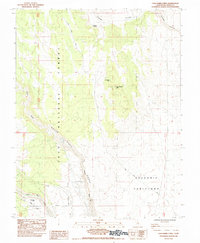
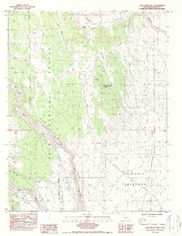
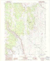
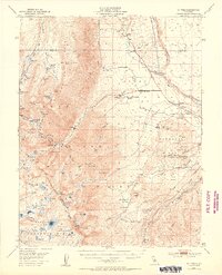
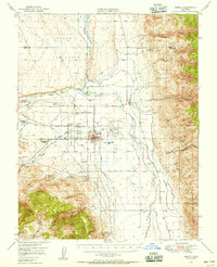
1984 Map of Casa Diablo Mtn
USGS Topo · Published 1984About this map
Casa Diablo Mtn and the surrounding Volcanic Tableland define this high-altitude landscape in Mono County during the mid-1980s. This transitional zone where the Inyo National Forest meets the arid eastern Sierra Nevada reveals a history of resource extraction and infrastructure development. The map details the Casa Diablo Mine and several nearby industrial features, including a Powerhouse, Surge Tank, and extensive Tailings piles near the Owens River.
Find a feature on this map
24 named features on this map. Tap any name to fly to it.
Don’t see what you’re looking for? This feature index may not catch every label — zoom into the map to look around manually.
Map Details
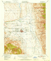
Editions of this 1984 Casa Diablo Mtn Map
3 editions found
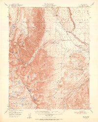
Other maps of this area

1912 · Mt. Goddard
USGS Topo · 1:125,000

1913 · Bishop
USGS Topo · 1:125,000

1914 · Mt. Morrison
USGS Topo · 1:125,000

1917 · White Mountain
USGS Topo · 1:125,000

1947 · Mariposa
USGS Topo · 1:250,000

1948 · Mariposa
USGS Topo · 1:250,000
1949 · Mt. Tom
USGS Topo · 1:62,500
1949 · Bishop
USGS Topo · 1:62,500
1951 · Mt. Tom
USGS Topo · 1:62,500
1951 · Bishop
USGS Topo · 1:62,500