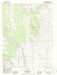
1984 Map of Casa Diablo Mtn
USGS Topo · Published 1987About this map
Casa Diablo Mtn dominates the high desert terrain where the eastern Sierra meets the Great Basin, overlooking the dramatic descent of the Owens Gorge. This 1980s-era documentation captures a landscape defined by significant geologic and industrial features, including the sprawling Volcanic Tableland and the Casa Diablo Mine located on the mountain's northern slopes. The map traces the critical hydroelectric infrastructure along the Owens River, marking the locations of the Powerhouse, Surge Tank, and a Gaging Station that manage the region's water resources. To the south, the terrain transitions toward Sherwin Hill, while the western boundary is defined by the Inyo National Forest. Historic transportation routes are well-preserved here, such as the Casa Diablo Road and the Old Grade, providing a clear view of how the area was navigated before modern realignments.
Find a feature on this map
19 named features on this map. Tap any name to fly to it.
Don’t see what you’re looking for? This feature index may not catch every label — zoom into the map to look around manually.
Map Details
Editions of this 1984 Casa Diablo Mtn Map
3 editions found
Other maps of this area

1912 · Mt. Goddard
USGS Topo · 1:125,000

1913 · Bishop
USGS Topo · 1:125,000

1914 · Mt. Morrison
USGS Topo · 1:125,000

1917 · White Mountain
USGS Topo · 1:125,000

1947 · Mariposa
USGS Topo · 1:250,000

1948 · Mariposa
USGS Topo · 1:250,000

1949 · Mt. Tom
USGS Topo · 1:62,500

1949 · Bishop
USGS Topo · 1:62,500

1951 · Mt. Tom
USGS Topo · 1:62,500

1951 · Bishop
USGS Topo · 1:62,500