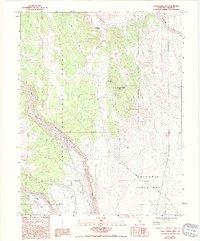
1984 Map of Casa Diablo Mtn
USGS Topo · Published 1994About this map
Inyo National Forest lands dominate this high-desert landscape in Mono County, where the dramatic incision of the Owens Gorge cuts through the surrounding Volcanic Tableland. Industrial activity and infrastructure are central to this area's history, evidenced by the Casa Diablo Mine and several prospects situated near the slopes of Casa Diablo Mtn. The Owens River flows through the gorge, supported by utility landmarks such as the Powerhouse and various tailings sites, reflecting the intersection of natural resources and energy development in the mid-1980s. Transportation through the high country is marked by the steep Sherwin Grade and a network of 4WD trails that lead toward Antelope Spring and Chidago Canyon. In the southern portion, Rock Creek passes by Sherwin Hill, offering a detailed view of the transition between the volcanic plateau and the river basin.
Find a feature on this map
22 named features on this map. Tap any name to fly to it.
Don’t see what you’re looking for? This feature index may not catch every label — zoom into the map to look around manually.
Map Details
Editions of this 1984 Casa Diablo Mtn Map
3 editions found
Other maps of this area

1912 · Mt. Goddard
USGS Topo · 1:125,000

1913 · Bishop
USGS Topo · 1:125,000

1914 · Mt. Morrison
USGS Topo · 1:125,000

1917 · White Mountain
USGS Topo · 1:125,000

1947 · Mariposa
USGS Topo · 1:250,000

1948 · Mariposa
USGS Topo · 1:250,000

1949 · Mt. Tom
USGS Topo · 1:62,500

1949 · Bishop
USGS Topo · 1:62,500

1951 · Mt. Tom
USGS Topo · 1:62,500

1951 · Bishop
USGS Topo · 1:62,500