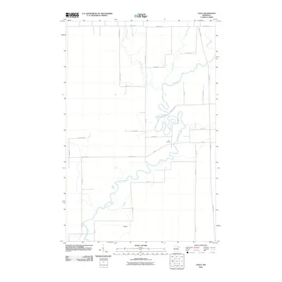
2010 Map of Casco
USGS Topo · Published 2010About this map
The Saint Louis River snakes through the center of this landscape in Saint Louis County, defining the local topography with its complex, meandering oxbows and bends. Near a particularly sharp turn in the river sits the Zim Cemetery, a significant landmark for those tracing local family roots in the area. The settlement of Casco occupies the southern portion of the quadrangle, serving as a hub for the surrounding network of rural roads that crisscross the low-lying terrain. To the north, the West Two River and East Two River flow southward to join the primary waterway. The map detail reflects a quiet, rural character, where large-scale development is minimal and the natural hydrology dictates the layout of local infrastructure like Zim Rd and County Hwy-25.
Find a feature on this map
29 named features on this map. Tap any name to fly to it.
Don’t see what you’re looking for? This feature index may not catch every label — zoom into the map to look around manually.
Map Details
Editions of this 2010 Casco Map
This is the sole edition of this map. No revisions or reprints were ever made.
Other maps of this area

1951 · Eveleth
USGS Topo · 1:24,000

1951 · Kirk
USGS Topo · 1:24,000

1951 · Zim
USGS Topo · 1:24,000

1951 · Casco
USGS Topo · 1:24,000

1951 · Buhl
USGS Topo · 1:24,000

1952 · Little Swan
USGS Topo · 1:24,000

1954 · Hibbing
USGS Topo · 1:250,000

1957 · Hibbing
USGS Topo · 1:250,000

1958 · Hibbing
USGS Topo · 1:250,000

1963 · Meadowlands NW
USGS Topo · 1:24,000