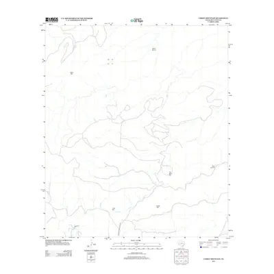
2012 Map of Casket Mountain
USGS Topo · Published 2012About this map
Davis Mountains State Park anchors the southern reaches of this high-desert landscape in Jeff Davis County. The terrain is defined by dramatic elevations and seasonal water sources, featuring prominent landmarks like Casket Mtn and Black Mtn. In a region where water is a vital resource, the drainage patterns of Cook Cr and Olds Cr are meticulously mapped alongside local catchment features such as Mill Tanks. This 2012 survey illustrates the sparse human footprint in this part of West Texas, concentrated primarily around Cook Flat and the winding path of Cedar Dr. The map provides a clear look at the intricate topography of the Trans-Pecos, from the deep incision of Hells Canyon to the broad plateau of Mesa Sproul and the distinct formation of The Nine Hill.
Find a feature on this map
11 named features on this map. Tap any name to fly to it.
Don’t see what you’re looking for? This feature index may not catch every label — zoom into the map to look around manually.
Map Details
Editions of this 2012 Casket Mountain Map
This is the sole edition of this map. No revisions or reprints were ever made.
Other maps of this area

1894 · Valentine
USGS Topo · 1:125,000

1894 · Fort Davis
USGS Topo · 1:125,000

1897 · Valentine
USGS Topo · 1:125,000

1897 · Fort Davis
USGS Topo · 1:125,000

1943 · Valentine
USGS Topo · 1:125,000

1954 · Fort Stockton
USGS Topo · 1:250,000

1958 · Fort Stockton
USGS Topo · 1:250,000

1959 · Marfa
USGS Topo · 1:250,000

1965 · Marfa
USGS Topo · 1:250,000

1972 · Casket Mountain
USGS Topo · 1:24,000