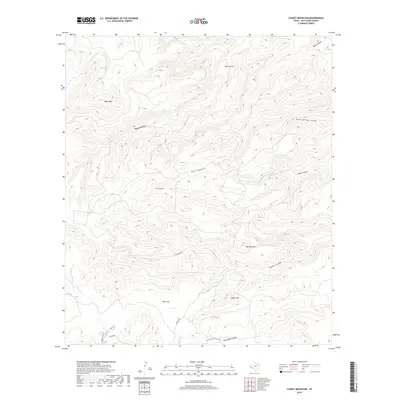
2019 Map of Casket Mountain
USGS Topo · Published 2019About this map
Casket Mtn and the surrounding high desert of Jeff Davis County are defined by a complex network of deep drainages and volcanic peaks. The landscape is dominated by notable relief, including Black Mtn in the north and the prominent Mesa Sproul. Human activity is primarily oriented around the few access points like Sproul Rd and specialized water infrastructure such as Mill Tanks. This 2019 survey shows the area's transition into the relatively level Cook Flat before the terrain descends into the branching systems of Big Aguja Canyon and Hells Canyon. The presence of the Sheep Pen Canyon Loop suggests a history of ranching or recreational usage in these high-altitude corridors, while drainage names like Bear Canyon and Horse Spring Canyon speak to the local environmental history of the Davis Mountains region.
Find a feature on this map
20 named features on this map. Tap any name to fly to it.
Don’t see what you’re looking for? This feature index may not catch every label — zoom into the map to look around manually.
Map Details
Editions of this 2019 Casket Mountain Map
This is the sole edition of this map. No revisions or reprints were ever made.
Other maps of this area

1894 · Valentine
USGS Topo · 1:125,000

1894 · Fort Davis
USGS Topo · 1:125,000

1897 · Valentine
USGS Topo · 1:125,000

1897 · Fort Davis
USGS Topo · 1:125,000

1943 · Valentine
USGS Topo · 1:125,000

1954 · Fort Stockton
USGS Topo · 1:250,000

1958 · Fort Stockton
USGS Topo · 1:250,000

1959 · Marfa
USGS Topo · 1:250,000

1965 · Marfa
USGS Topo · 1:250,000

1972 · Casket Mountain
USGS Topo · 1:24,000