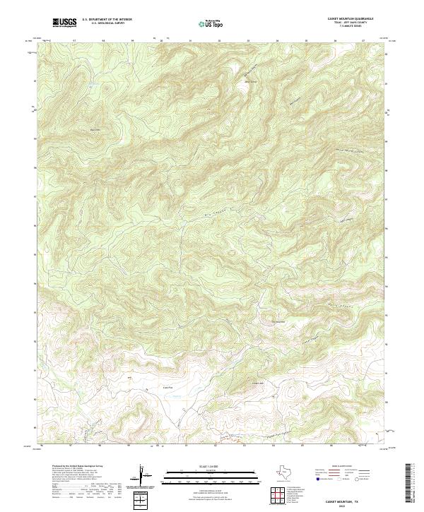
2022 Map of Casket Mountain
USGS Topo · Published 2022About this map
Casket Mountain and Black Mountain anchor this high-elevation landscape in the Davis Mountains, where the terrain is defined by a dense network of drainage systems. The topography is deeply incised by major features such as Big Aguja Canyon, Hells Canyon, and Horse Spring Canyon, which create a complex vertical relief. A historical reliance on managed water in this arid environment is evident at Mill Tanks in the northern reaches, while the lower elevations near Cook Flat and along Sproul Road suggest the primary corridors for movement through the district. Small seasonal drainages like Olds Creek and Cook Creek feed into the larger canyon systems, illustrating the hydrological patterns that have shaped land use and ranching access in this portion of Jeff Davis County.
Find a feature on this map
21 named features on this map. Tap any name to fly to it.
Don’t see what you’re looking for? This feature index may not catch every label — zoom into the map to look around manually.
Map Details
Editions of this 2022 Casket Mountain Map
This is the sole edition of this map. No revisions or reprints were ever made.
Other maps of this area

1894 · Valentine
USGS Topo · 1:125,000

1894 · Fort Davis
USGS Topo · 1:125,000

1897 · Valentine
USGS Topo · 1:125,000

1897 · Fort Davis
USGS Topo · 1:125,000

1943 · Valentine
USGS Topo · 1:125,000

1954 · Fort Stockton
USGS Topo · 1:250,000

1958 · Fort Stockton
USGS Topo · 1:250,000

1959 · Marfa
USGS Topo · 1:250,000

1965 · Marfa
USGS Topo · 1:250,000

1972 · Casket Mountain
USGS Topo · 1:24,000