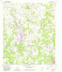
1964 Map of Cason
USGS Topo · Published 1980About this map
The settlement of Cason serves as a focal point in this portion of Northeast Texas, situated where the Louisiana and Arkansas rail line intersects the local road network. The landscape is defined by the drainages of Swauano Creek and Boggy Creek, which flow toward Big Cypress Creek at the southern edge of the survey. A significant industrial feature is the Power Plant and its associated cooling pond, which was undergoing expansion during the late 1970s as indicated by the purple hatching for areas to be submerged.
Find a feature on this map
33 named features on this map. Tap any name to fly to it.
Don’t see what you’re looking for? This feature index may not catch every label — zoom into the map to look around manually.
Map Details
Editions of this 1964 Cason Map
2 editions found
Other maps of this area

1914 · Daingerfield
USGS Topo · 1:62,500

1953 · Texarkana
USGS Topo · 1:250,000

1956 · Texarkana
USGS Topo · 1:250,000

1956 · Tyler
USGS Topo · 1:250,000

1960 · La Fayette
USGS Topo · 1:24,000

1960 · Pittsburg
USGS Topo · 1:24,000

1962 · Lone Star
USGS Topo · 1:24,000

1964 · Harvard
USGS Topo · 1:24,000

1964 · Daingerfield
USGS Topo · 1:24,000

1964 · Cason
USGS Topo · 1:24,000