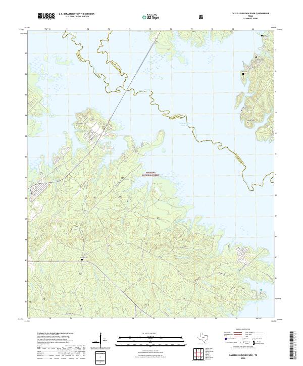
2022 Map of Cassells-Boykin Park
USGS Topo · Published 2022About this map
Angelina National Forest dominates this East Texas landscape, where the meandering Angelina River forms a jagged natural boundary between San Augustine, Angelina, and Nacogdoches counties. The map centers on the sprawling fingers of the Sam Rayburn Reservoir, a massive impoundment that dramatically altered the local topography. The terrestrial areas are defined by a network of timber and forest service roads like Mud Creek Rd and Co Rd 345, which wind through the upland piney woods.
Find a feature on this map
43 named features on this map. Tap any name to fly to it.
Don’t see what you’re looking for? This feature index may not catch every label — zoom into the map to look around manually.
Map Details
Editions of this 2022 Cassells-Boykin Park Map
This is the sole edition of this map. No revisions or reprints were ever made.
Other maps of this area

1928 · Zavalla 3-c
USGS Topo · 1:24,000

1931 · Zavalla
USGS Topo · 1:62,500

1953 · Palestine
USGS Topo · 1:250,000

1957 · Palestine
USGS Topo · 1:250,000

1958 · Zavalla
USGS Topo · 1:62,500

1958 · Broaddus
USGS Topo · 1:62,500

1958 · Mc Gee Bend
USGS Topo · 1:62,500

1958 · Bronson
USGS Topo · 1:62,500
1984 · Veach
USGS Topo · 1:24,000
1984 · Harvey Creek
USGS Topo · 1:24,000