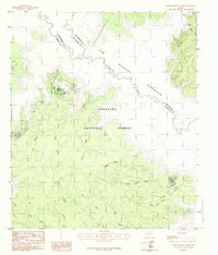
1984 Map of Cassells-Boykin Park
USGS Topo · Published 1984About this map
The Sam Rayburn Reservoir and the Angelina River dominate this East Texas landscape, where the waters intersect with the dense woodlands of the Angelina National Forest. This 1984 provisional survey documents a region defined by its complex drainage network and recreation potential, anchored by Cassells-Boykin Park. The map reveals a transitional landscape where the boundaries of Nacogdoches, San Augustine, and Angelina Counties meet amidst a maze of winding waterways and heavily timbered terrain.
Find a feature on this map
21 named features on this map. Tap any name to fly to it.
Don’t see what you’re looking for? This feature index may not catch every label — zoom into the map to look around manually.
Map Details
Editions of this 1984 Cassells-Boykin Park Map
This is the sole edition of this map. No revisions or reprints were ever made.
Other maps of this area

1928 · Zavalla 3-c
USGS Topo · 1:24,000

1931 · Zavalla
USGS Topo · 1:62,500

1953 · Palestine
USGS Topo · 1:250,000

1957 · Palestine
USGS Topo · 1:250,000

1958 · Zavalla
USGS Topo · 1:62,500

1958 · Broaddus
USGS Topo · 1:62,500

1958 · Mc Gee Bend
USGS Topo · 1:62,500

1958 · Bronson
USGS Topo · 1:62,500
1984 · Veach
USGS Topo · 1:24,000
1984 · Harvey Creek
USGS Topo · 1:24,000