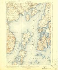
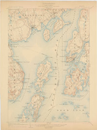
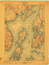
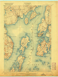
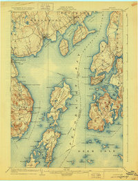
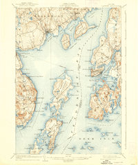
1904 Map of Castine
USGS Topo · Published 1941About this map
The maritime communities of Penobscot Bay appear in this early twentieth-century survey, reflecting an era when coastal life was defined by protected harbors and seasonal gatherings. Castine occupies its strategic peninsula overlooking Castine Harbor, while across the bay, the extensive grounds of the Northport Camp Ground suggest the region's developing role as a summer destination. The long, narrow profile of Islesboro dominates the center of the map, characterized by numerous small inlets such as Seal Harbor and Dark Harbor that provided vital shelter for local vessels.
Find a feature on this map
116 named features on this map. Tap any name to fly to it.
Don’t see what you’re looking for? This feature index may not catch every label — zoom into the map to look around manually.
Map Details
Editions of this 1904 Castine Map
7 editions found
Other maps of this area

1900 · Orland
USGS Topo · 1:62,500

1900 · Bucksport
USGS Topo · 1:62,500

1902 · Bucksport
USGS Topo · 1:62,500

1902 · Castine
USGS Topo · 1:62,500

1904 · Deer Isle
USGS Topo · 1:62,500

1904 · Castine
USGS Topo · 1:62,500

1904 · Bluehill
USGS Topo · 1:62,500

1904 · Vinalhaven
USGS Topo · 1:62,500

1904 · Rockland
USGS Topo · 1:62,500

1905 · Penobscot Bay
USGS Topo · 1:125,000