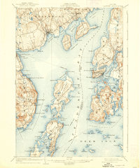
1904 Map of Castine
USGS Topo · Published 1938About this map
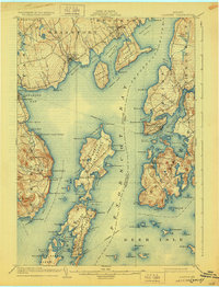
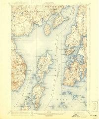
Castine and the surrounding coastal reaches of Penobscot Bay appear here during a period of active maritime commerce and early 20th-century resort life. The map details a complex network of island communities and waterfront settlements, including the historic military site at Fort George and the religious assembly grounds at Northport Camp Ground. The importance of water-based transit is evident through the explicitly marked Steamboat Route connecting points like Searsport Harbor, Islesboro, and Castine Harbor.
Find a feature on this map
128 named features on this map. Tap any name to fly to it.
Don’t see what you’re looking for? This feature index may not catch every label — zoom into the map to look around manually.
Map Details
Editions of this 1904 Castine Map
7 editions found
Other maps of this area

1900 · Orland
USGS Topo · 1:62,500

1900 · Bucksport
USGS Topo · 1:62,500

1902 · Bucksport
USGS Topo · 1:62,500

1902 · Castine
USGS Topo · 1:62,500

1904 · Deer Isle
USGS Topo · 1:62,500

1904 · Castine
USGS Topo · 1:62,500

1904 · Bluehill
USGS Topo · 1:62,500

1904 · Vinalhaven
USGS Topo · 1:62,500

1904 · Rockland
USGS Topo · 1:62,500

1905 · Penobscot Bay
USGS Topo · 1:125,000