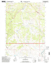
1991 Map of Castle Rock
USGS Topo · Published 1997About this map
Shoshone National Forest and the Washakie Wilderness dominate this high-altitude landscape in Fremont County, where the topographic relief is defined by prominent features like Castle Rock and Mount Kent. The map details a remote wilderness managed by the Forest Service, highlighting the East Fork Elk Winter Pasture (Hdqrs) at its southwestern edge. The hydrology of the region is characterized by thermal and alpine water sources, including Alkali Bog (Mud Springs), Waynes Hole Spring, and Goose Lake. Steep drainages like Alkali Creek and Bear Creek flow through deep basins, while ridges such as Diamond Ridge and Finley Ridge provide natural corridors. The lack of improved roads, replaced by a sparse network of 4WD tracks, underscores the preservation of this area in the early 1990s as a crucial wildlife habitat and protected natural zone.
Find a feature on this map
70 named features on this map. Tap any name to fly to it.
Don’t see what you’re looking for? This feature index may not catch every label — zoom into the map to look around manually.
Map Details
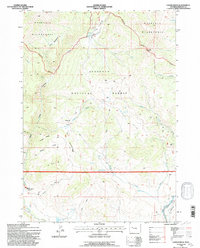
Editions of this 1991 Castle Rock Map
2 editions found
Other maps of this area

1904 · Kirwin
USGS Topo · 1:125,000

1905 · Younts Peak
USGS Topo · 1:125,000

1906 · Kirwin
USGS Topo · 1:125,000

1907 · Younts Peak
USGS Topo · 1:125,000

1955 · Thermopolis
USGS Topo · 1:250,000

1956 · Indian Point
USGS Topo · 1:24,000

1956 · Snow Lake
USGS Topo · 1:24,000

1956 · Mason Draw
USGS Topo · 1:24,000

1958 · Thermopolis
USGS Topo · 1:250,000

1962 · Thermopolis
USGS Topo · 1:250,000