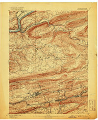
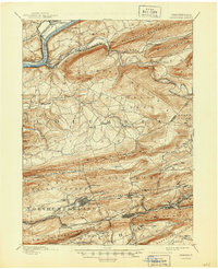
1894 Map of Catawissa
USGS Topo · Published 1920About this map
The Susquehanna River bends sharply at Catawissa, a vital transportation junction where the Catawissa Bridge and Bloomsburg Ferry connected the region before the full dominance of the automobile. This survey captures the intensive industrial landscape of the late nineteenth century, dominated by a dense web of competing rail lines including the Philadelphia and Reading Railroad Catawissa Div. and the Lehigh Valley Railroad.
Find a feature on this map
81 named features on this map. Tap any name to fly to it.
Don’t see what you’re looking for? This feature index may not catch every label — zoom into the map to look around manually.
Map Details
Editions of this 1894 Catawissa Map
6 editions found

Other maps of this area

1889 · Catawissa
USGS Topo · 1:62,500

1889 · Pottsville
USGS Topo · 1:62,500

1891 · Pottsville
USGS Topo · 1:62,500

1892 · Catawissa
USGS Topo · 1:62,500

1892 · Lykens
USGS Topo · 1:62,500

1892 · Shamokin
USGS Topo · 1:62,500

1892 · Mahanoy
USGS Topo · 1:62,500

1892 · Pine Grove
USGS Topo · 1:62,500

1893 · Lykens
USGS Topo · 1:62,500

1893 · Shamokin
USGS Topo · 1:62,500