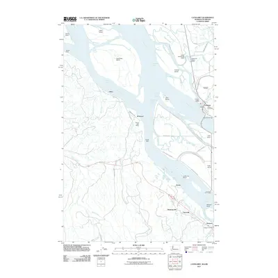
2011 Map of Cathlamet
USGS Topo · Published 2011About this map
Tenasillahe Island and the complex web of the Columbia River define this stretch of the Pacific Northwest border. The map documents the intricate hydrology of the estuary, where major landmasses like Puget Island are threaded by Birnie Slough, Brown Slough, and Duncan Slough. The settlement of Cathlamet serves as a focal point on the Washington side, connected to the island by the Puget Island Bridge. On the Oregon bank, the small communities of Westport, Wauna, and the vanished site of Bradwood represent the industrial and maritime history of the river, with the Westport Post Office and local landmarks like Hunts Mill Point anchoring the riverfront. The terrain transitions from the low-lying Lower Elochoman Valley to the elevated relief of Oklahoma Hill, illustrating how the geography dictated the placement of early infrastructure like the Puget Island Ferry Landing.
Find a feature on this map
76 named features on this map. Tap any name to fly to it.
Don’t see what you’re looking for? This feature index may not catch every label — zoom into the map to look around manually.
Map Details
Editions of this 2011 Cathlamet Map
This is the sole edition of this map. No revisions or reprints were ever made.
Other maps of this area

1940 · Svensen
USGS Topo · 1:62,500

1940 · Brookfield
USGS Topo · 1:62,500

1941 · Skamokawa
USGS Topo · 1:62,500

1941 · Cathlamet
USGS Topo · 1:62,500

1953 · Hoquiam
USGS Topo · 1:250,000

1953 · Skamokawa
USGS Topo · 1:62,500

1953 · Cathlamet
USGS Topo · 1:62,500
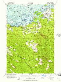
1955 · Svensen
USGS Topo · 1:62,500

1955 · Grays River
USGS Topo · 1:62,500

1957 · Hoquiam
USGS Topo · 1:250,000