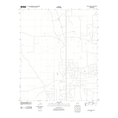
2010 Map of Caudill Ranch
USGS Topo · Published 2010About this map
Mescalero Ridge dominates this section of the High Plains, carving a distinct geological boundary through the arid Lea County landscape. This 2010 survey highlights the industrial footprint of the Caprock Oil Field, where a network of access roads and infrastructure supports the region's long-standing petroleum economy. The namesake Caudill Ranch serves as a central landmark amidst the open range, illustrating the dual-use nature of this land for both traditional ranching and modern resource extraction.
Find a feature on this map
8 named features on this map. Tap any name to fly to it.
Don’t see what you’re looking for? This feature index may not catch every label — zoom into the map to look around manually.
Map Details
Editions of this 2010 Caudill Ranch Map
This is the sole edition of this map. No revisions or reprints were ever made.
Other maps of this area

1954 · Brownfield
USGS Topo · 1:250,000

1958 · Brownfield
USGS Topo · 1:250,000

1962 · Brownfield
USGS Topo · 1:250,000

1973 · Culp Ranch
USGS Topo · 1:24,000
1973 · Cedar Point
USGS Topo · 1:24,000

1973 · Mescalero Point
USGS Topo · 1:24,000

1973 · Soldier Hill
USGS Topo · 1:24,000

1973 · Caudill Ranch
USGS Topo · 1:24,000

1973 · Cooper-Good Ranch
USGS Topo · 1:24,000

1973 · Dean Ranch
USGS Topo · 1:24,000