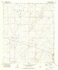
1973 Map of Cedar Point
USGS Topo · Published 1976About this map
The Vest Camp Oil Field and Sulimar Oil Field dominate this section of the Chaves County high plains, showcasing the intensive energy extraction infrastructure of the early 1970s. The landscape is a dense network of industrial activity, marked by numerous drill holes, oil wells, and a central pumping station connected by a complex system of pipelines.
Find a feature on this map
21 named features on this map. Tap any name to fly to it.
Don’t see what you’re looking for? This feature index may not catch every label — zoom into the map to look around manually.
Map Details
Editions of this 1973 Cedar Point Map
2 editions found
Other maps of this area

1951 · King Camp
USGS Topo · 1:24,000

1952 · Connor Well
USGS Topo · 1:24,000

1953 · Basin Well
USGS Topo · 1:24,000

1954 · Carlsbad
USGS Topo · 1:250,000

1954 · Hobbs
USGS Topo · 1:250,000

1954 · Brownfield
USGS Topo · 1:250,000

1955 · Roswell
USGS Topo · 1:250,000

1958 · Carlsbad
USGS Topo · 1:250,000

1958 · Brownfield
USGS Topo · 1:250,000

1958 · Roswell
USGS Topo · 1:250,000