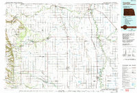
1985 Map of Cavalier
USGS Topo · Published 1992About this map
The Red River of the North forms a winding international and state boundary in this 1980s landscape, separating North Dakota from Minnesota and Canada. The region is defined by the sharp transition from the flat agricultural plains of the Red River Valley to the elevated Pembina Hills and Horgan Ridge in the west. This area is heavily managed for conservation, featuring an extensive network of preserves including the Tongue River State Wildlife Management Area and Icelandic State Park.
Find a feature on this map
113 named features on this map. Tap any name to fly to it.
Don’t see what you’re looking for? This feature index may not catch every label — zoom into the map to look around manually.
Map Details
Editions of this 1985 Cavalier Map
2 editions found
Other maps of this area

1918 · Walhalla
USGS Topo · 1:62,500

1918 · Acton
USGS Topo · 1:62,500

1918 · Argyle
USGS Topo · 1:62,500

1939 · Drayton
USGS Topo · 1:62,500

1939 · Glasston
USGS Topo · 1:62,500

1939 · Pembina
USGS Topo · 1:62,500

1939 · Cavalier
USGS Topo · 1:62,500

1939 · Kennedy
USGS Topo · 1:62,500

1941 · Kennedy
USGS Topo · 1:62,500

1941 · Drayton
USGS Topo · 1:62,500