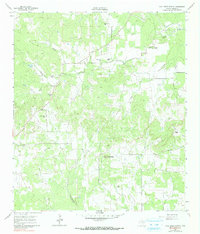
1961 Map of Cave Creek School
USGS Topo · Published 1991About this map
Family-named ranches and small rural institutions define this Gillespie County landscape as it appeared in the early 1960s. The area is anchored by the namesake Cave Creek Sch and the Cave Creek Ch, with nearby Cave Creek Cem serving as a central point for the local farming community. The terrain is marked by significant drainage systems including North Grape Creek and Spring Creek, which wind between named elevations like Roundhead.
Find a feature on this map
23 named features on this map. Tap any name to fly to it.
Don’t see what you’re looking for? This feature index may not catch every label — zoom into the map to look around manually.
Map Details
Editions of this 1961 Cave Creek School Map
Other maps of this area

1894 · Fredericksburg
USGS Topo · 1:125,000

1954 · Llano
USGS Topo · 1:250,000

1955 · Llano
USGS Topo · 1:250,000

1956 · Llano
USGS Topo · 1:250,000

1961 · Stonewall
USGS Topo · 1:24,000

1961 · Hye
USGS Topo · 1:24,000

1961 · Cave Creek School
USGS Topo · 1:24,000

1961 · Rocky Creek
USGS Topo · 1:24,000

1963 · Cain City
USGS Topo · 1:24,000

1967 · Fredericksburg East
USGS Topo · 1:24,000