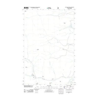
2011 Map of Cave Mountain
USGS Topo · Published 2011About this map
Choteau Mountain and Cave Mountain anchor this high-elevation landscape in Teton County, where the Rocky Mountain Front meets the plains. The drainage network is complex, defined by the North Fork Teton River and its various tributaries including the Middle Fork North Fork Teton River and South Fork Teton River. Settlement in this region is characterized by isolated livestock operations such as Burfening Ranch, Lazy P Ranch, and Cow Track Ranch, situated along the lower river valleys. The presence of the Middle Fork Trailhead and roads like Teton Canyon Rd suggests a landscape used for both ranching and back-country access. In the northern reaches, Muddy Creek and Rinker Creek cut through the terrain near prominent landmarks like Antelope Butte and Mount Werner.
Find a feature on this map
26 named features on this map. Tap any name to fly to it.
Don’t see what you’re looking for? This feature index may not catch every label — zoom into the map to look around manually.
Map Details
Editions of this 2011 Cave Mountain Map
This is the sole edition of this map. No revisions or reprints were ever made.
Other maps of this area

1903 · Saypo
USGS Topo · 1:125,000

1914 · Heart Butte
USGS Topo · 1:125,000

1918 · Heart Butte
USGS Topo · 1:125,000

1955 · Choteau
USGS Topo · 1:250,000

1957 · Choteau
USGS Topo · 1:250,000

1958 · Choteau
USGS Topo · 1:250,000

1958 · Ear Mountain
USGS Topo · 1:24,000

1958 · Lake Theboe
USGS Topo · 1:24,000

1958 · Cave Mountain
USGS Topo · 1:24,000

1958 · Mount Wright
USGS Topo · 1:24,000