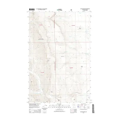
2014 Map of Cave Mountain
USGS Topo · Published 2014About this map
Lewis & Clark National Forest encompasses the majority of this territory, where the eastern front of the Rocky Mountains meets the high plains. The landscape is defined by the complex drainage network of the Teton River, including its north, middle, and south forks, which have carved deep features like Frenchy Gulf and Clary Coulee into the limestone. High-elevation landmarks such as Mt Werner and Chateau Mtn dominate the western skyline, while the transition to the plains is marked by isolated formations like Antelope Butte and Crab Butte. This 2014 survey documents the road network at the forest boundary, including Teton Canyon Rd and the Teton Canyon Loop, which provide access to geological landmarks such as Indian Head Rock and the namesake Cave Mtn. The map clearly illustrates the shift from protected national forest land to private or state-managed sections to the east.
Find a feature on this map
39 named features on this map. Tap any name to fly to it.
Don’t see what you’re looking for? This feature index may not catch every label — zoom into the map to look around manually.
Map Details
Editions of this 2014 Cave Mountain Map
This is the sole edition of this map. No revisions or reprints were ever made.
Other maps of this area

1903 · Saypo
USGS Topo · 1:125,000

1914 · Heart Butte
USGS Topo · 1:125,000

1918 · Heart Butte
USGS Topo · 1:125,000

1955 · Choteau
USGS Topo · 1:250,000

1957 · Choteau
USGS Topo · 1:250,000

1958 · Choteau
USGS Topo · 1:250,000

1958 · Ear Mountain
USGS Topo · 1:24,000

1958 · Lake Theboe
USGS Topo · 1:24,000

1958 · Cave Mountain
USGS Topo · 1:24,000

1958 · Mount Wright
USGS Topo · 1:24,000